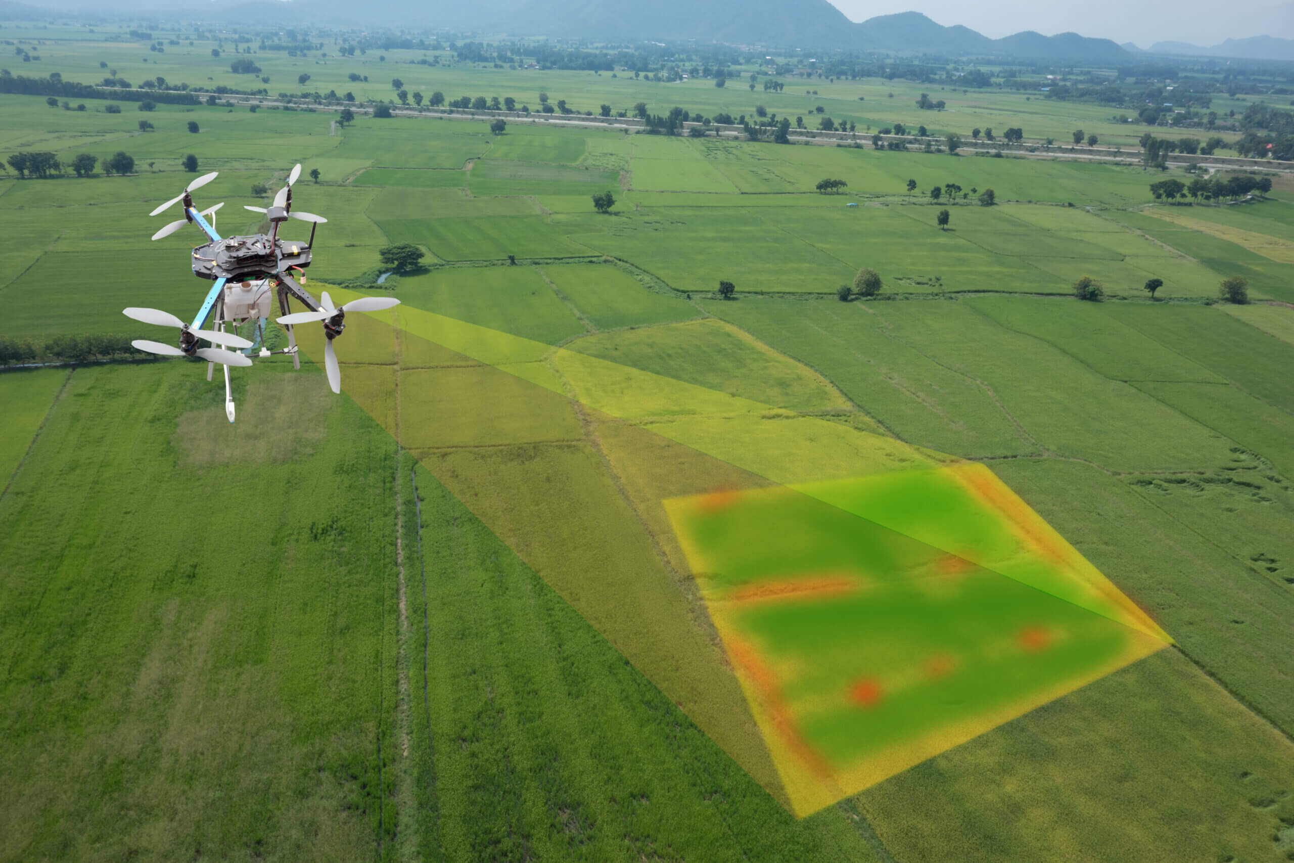
Multi-spectral crop analysis involves the use of satellite or aerial imagery captured at different wavelengths across the electromagnetic spectrum to monitor and analyze the health and characteristics of crops. Each wavelength provides unique information about the vegetation, allowing for a more comprehensive understanding of crop conditions.
In multi-spectral imaging, additional bands are incorporated, allowing for the capture of information beyond the visible spectrum, such as infrared and ultraviolet wavelengths. Each spectral band provides unique information about the reflectance or emission properties of objects and materials, enabling enhanced analysis and interpretation of the captured data.
In summary, multi-spectral crop analysis can be a valuable tool in construction projects for assessing and monitoring the environmental impact, preserving vegetation, and ensuring compliance with regulations. It allows for a more holistic understanding of the land and its ecological characteristics before, during, and after construction activities.